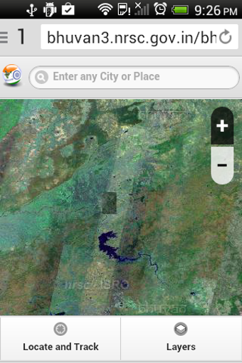
Satellite imagery exploration and navigation solution
ISRO BHUVAN INDIAN LIVE is a web-based 3D satellite imagery tool that enhances your geographical awareness by providing detailed views of Indian locations. This reference makes exploring Indian terrain a breeze. You can select locations and view them from various perspectives, with spatial resolutions ranging from five to 100 meters.
A comprehensive geographical overview
ISRO BHUVAN INDIAN LIVE excels in providing detailed insights into Indian landscapes. Whether you're curious about specific locations or need to measure distances, this tool ensures accurate and high-resolution imagery. It is beneficial for users conducting geographical studies or educational activities, offering a seamless and comprehensive overview of Indian topography.
However, the tool is exclusively focused on Indian locations, which means it cannot be used for global exploration. Additionally, it doesn't provide imagery of military installations due to security concerns, which might be a limitation for users requiring complete coverage. These factors could restrict its applicability for some potential users.
A reliable exploration tool
ISRO BHUVAN INDIAN LIVE delivers a valuable service for those keen on exploring Indian geography in detail. While it is limited to Indian locations and excludes military installations, the app's overall performance makes it a worthwhile addition to your geographical research toolkit.